The National Weather Service in Anchorage has issued a special weather statement for accumulating snow Saturday April 8th, through Sunday April 9th for South Central Alaska, including the Western Kenai Peninsula.
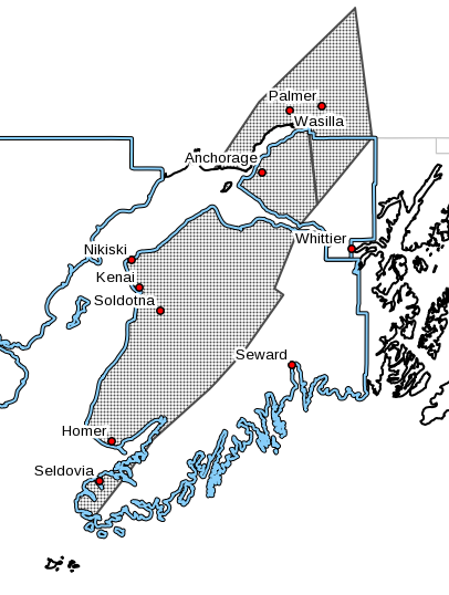
According to the the National Weather Service, A complex area of low pressure moving toward the region from the Gulf of Alaska will bring accumulating snow to the Matanuska Valley, Anchorage Bowl, and Kenai Peninsula for the weekend.
An initial round of light snow will develop Saturday night and could taper off briefly late Saturday night before a second round of heavier snow develops Sunday morning.
Heaviest snowfall rates will likely be Sunday morning with light snow continuing through the day before tapering off Sunday night.
Although there is still uncertainty in the exact track and timing of this system, 2 to 4 inches of snow is likely for most locations with locally higher amounts possible in East Anchorage, the Anchorage Hillside, and along the Glenn and Seward Highways and along the Sterling Highway east of Soldotna.
Visibility may also be reduced at times Sunday morning due to the combination of potentially higher snowfall rates and resuspended snow from vehicular traffic.
For the latest forecast, visit www.weather.gov/afc