The lightning-caused East Fork Fire remains approximately 1,016 acres with 145 personnel assigned. The fire continues to burn in a limited protection area about 4.5 miles north of the Sterling Highway and 3.5 miles east of the nearest residential area.
A warming and drying trend is predicted for the weekend. However, if the fire activity remains moderate and the objectives are being met, then there will be no need at this time for the strategic burnout operation. As discussed earlier in the week, the burnout remains an option to help manage the fire on the southern and western flanks.
Firefighters continue to improve the new fuel break that runs from the fire’s southwest corner, about 2 ½ miles south to the ENSTAR natural gas pipeline, and lay water hose along the fire break and the pipeline easement. This work will assist with the burnout operation if conditions change, causing the fire to become active again and threaten the Sterling Highway and community of Sterling. The public is asked to please steer clear of crews working in the area.
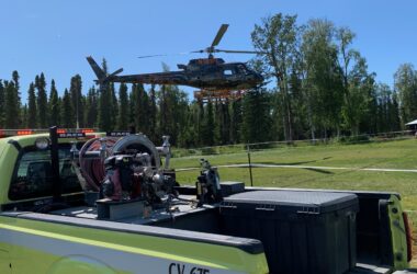
The Division of Forestry reminds pilots of the temporary flight restriction (TFR) in place over the fire to provide for the safety of fire-related aircraft operations has been modified. Pilots should check with the Federal Aviation Administration before flying in the area. The most up to date TFR is available at http://tfr.faa.gov/tfr2/list.html.
The public is asked to please steer clear of crews working in the area and be aware of the potential for aircraft using Skilak Lake to scoop water.
During wet weather days, residents are encouraged to take steps on their own properties to reduce wildfire risk using tips found on the FireWise website: http://www.firewise.org/wildfire-preparedness/firewise-toolkit.aspx
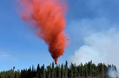
Photo Credit: Robert Jeager