UPDATE – HIGH WIND WATCH AND FLOOD WATCH IN EFFECT FOR SEWARD & MOOSE PASS – High Wind Watch in effect from late tonight through Friday afternoon along eastern Turnagain Arm and through Portage Valley.
East winds 45-to-65 mph with gusts up to 80 mph possible. Impacts include high winds which could move loose debris, damage property, and cause power outages. Travel could be difficult, especially for high profile vehicles.
The National Weather Service in Anchorage reports that a high wind watch means there is potential for a hazardous high wind event. Monitor the latest forecasts and warnings for updates on this situation. Fasten loose objects or shelter objects in a safe location prior to the onset of winds.
A Flood Watch remains in effect through Sunday afternoon through Sunday afternoon for Seward and the Bear Creek area. NWS Anchorage reports a total of 7-to-10 inches of rain is expected to fall through Sunday afternoon. The heaviest rain is expected to fall late Thursday evening through Friday afternoon, Saturday morning through Saturday afternoon and Sunday afternoon. This will lead to sharp rises in local rivers and creeks, as well as large amounts of gravel and sediment transport. Sediment loading in the creeks, along with higher stream flow will likely cause flooding.
The Resurrection River is forecast to exceed flood stage. If this occurs, flooding of the runway at Seward Airport, especially during high tides, is likely. There is the potential for high water throughout the area, with water over roads. Some washouts along Salmon Creek, Bear Creek, Lost Creek, Japanese Creek, and surrounding areas are also possible. This series of storms looks similar to the October 2018 event.
A flood watch means there is a potential for flooding. You are encouraged to closely monitor this weather situation. Preparation for this potentially dangerous weather event should begin now.
ORIGINAL STORY – Potential flooding on the Kenai River is forecast for this weekend through the early part of next week.
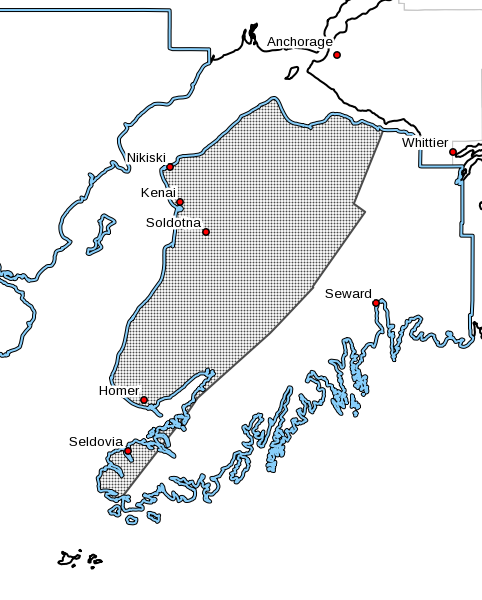
The National Weather Service in Anchorage is reporting that heavy rainfall is scheduled for the eastern Kenai Peninsula through the weekend and it is forecasted to bring the potential for flooding conditions to parts of the Kenai River by Sunday.
According to report, the Kenai River near Cooper Landing could reach minor flood conditions Sunday morning and the Kenai Keys area by Sunday evening.
These flood conditions could last a couple of days.
People near the Kenai River should take precaution.