According to the National Weather Service in Anchorage, a low pressure system will move in from the west Tuesday, bringing a front that will lift from southwest to northeast over Southcentral beginning Tuesday night.
 Snow is expected to spread in over the Kenai Peninsula beginning Tuesday night. Snow will then fill in across the northern Gulf coast, Susitna Valley, Matanuska Valley, and Copper River Basin early Wednesday morning. For the Anchorage Bowl, light snow may start during the overnight hours Tuesday into early Wednesday, with heavier snow filling in by Wednesday afternoon. This is due to an initial “downsloping” effect that will postpone the start time of snow for the Bowl.
Model solutions have not shown great consistency with this event, which has led to low confidence in snow amounts. Please be sure to check the latest forecast at weather.gov/Anchorage for updated information. We continue to monitor and track this event and will publish forecast updates regularly as we analyze new information.
At this time, we expect the following snowfall totals for the duration of this event from Tuesday through Wednesday. Please note these are subject to change as the forecast evolves:
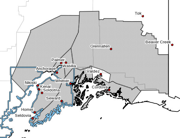
- Western Kenai Peninsula: 3 to 6 inches
- Eastern Kenai Peninsula: 5 to 10 inches; highest amounts near Portage Valley
- Anchorage Bowl: 2 to 4 inches
- Susitna Valley: 3 to 7 inches; highest amounts west of Parks Highway
- Matanuska Valley: 3 to 5 inches
- Copper River Basin: 1 to 3 inches